Llandaff -


The City -
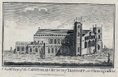
John Speed’s plan of Llandaff, published in 1610 shows that the village had grown into a compact little township of sixty or more houses and the present street pattern had already become established. Although the plan shows the Cathedral as structurally complete, it was progressively neglected until at the beginning of the eighteenth century most of it was unroofed.
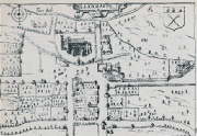
The large building to the right of the map is Bryn Gynnen, the ancestral home of the Mathews family. In the 1740s it was demolished and replaced by Llandaff Court, now the Cathedral School. The straight road from the Castle past Bryn Gynnen joined Cardiff Road at Mill Lane to the east, and Bridge Street to Llantrisant Road to the west. This road is a more direct route than Cardiff Road, which was known as ‘back road’ or the village by-
During the Civil War the Cathedral and parish suffered many indignities and at the lowest depth of its degradation the Cathedral is said to have been ‘turned into an ale house, the choir became a calf pen, one part of the building was used as a stable and another as a post office and the font became a hot trough’.
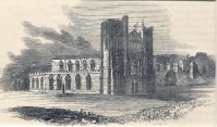
Storms in 1704 and 1720 damaged the north and south towers, and caused the roof supports to collapse. An appeal was made to restore the building and work began in 1743. But as money was constantly in short supply, it was carried out in a hotch-
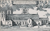
Nearby Llandaff Court was also being rebuilt for Admiral Thomas Mathew, as a typical three-
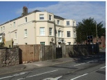
4
4